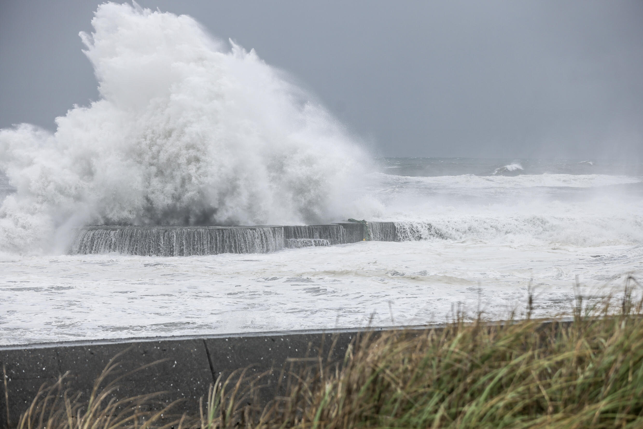
A powerful typhoon struck northeastern Taiwan early on Thursday, resulting in at least two fatalities and hundreds of injuries as authorities shut down financial markets, schools, and offices.
Typhoon Gaemi brought worsening conditions to Taiwan, including heavy rainfall, strong winds, and a dangerous storm surge. It made landfall in Yilan County with sustained winds reaching up to 205 kph (125 mph), which is equivalent to a Category 3 major hurricane in the Atlantic.
The typhoon is anticipated to traverse the Taiwan Strait on Thursday before reaching mainland China’s Fujian province. This will bring additional strong winds and heavy rain to a region already suffering from weeks of severe rain and deadly flooding.
Taiwan’s Central Emergency Operations Center reported that a woman in Kaohsiung City was killed by a fallen tree while riding a motorcycle, and another woman in Hualien died when a parapet fell from a house roof. Over 200 people have been injured.
Initially, the storm was expected to become a super typhoon before its Wednesday afternoon landfall on Taiwan’s northeast coast.
However, the typhoon was redirected from its forecast path by Taiwan’s mountainous terrain, causing it to spend over six hours offshore, looping near the Hualien coastline before making landfall around midnight.
Hualien, the most populous city in eastern Taiwan, endured an additional eight hours of the typhoon’s severe conditions, including winds exceeding 100 mph (160 kph), storm surge, and intense rainfall. Many areas received over 300 mm (1 foot) of rain, with mountainous regions getting more than 500 mm (1.5 feet).
The deflection was attributed to the mountains disrupting the storm’s wind field, a phenomenon observed multiple times over the past 60 years in typhoons approaching northeast Taiwan, with several storms making full loops before moving over land.
In preparation for Typhoon Gaemi, businesses in Taipei taped windows on July 23, 2024. Taiwan is frequently affected by typhoons and generally has a strong record in preparing for their impacts, particularly in urban areas.
However, remote and mountainous regions, especially on the island’s eastern side, are more vulnerable to landslides and other dangers.
Taiwan’s Central Meteorological Agency (CMA) issued typhoon warnings for both sea and land across the entire main island. President Lai Ching-te advised residents to avoid travel unless absolutely necessary and safe.
Before hitting Taiwan, Typhoon Gaemi intensified in the Pacific, where sea temperatures are at record highs.
It became the first typhoon of the season to affect Taiwan, intensifying by 96 kph (60 mph) in just 24 hours, surpassing the rapid intensification threshold of 56 kph (35 mph). Scientists link these rapid intensifications to warmer oceans caused by climate change.

On Wednesday, most Taiwanese cities closed schools and offices, while Taiwan Railways halted some rapid train services. Over 50,000 households in Kaohsiung lost power.
Many flights and all regular train services were canceled for Wednesday and Thursday. Taiwan’s largest airlines, including EVA Air, China Airlines, and Starlux Airlines, announced disruptions due to the typhoon.
Taiwan’s defense authorities had to adjust their annual five-day Han Kuang War Games because of the typhoon. These live-fire drills are the largest annual military exercises in Taiwan, where the armed forces are on high alert against potential threats from China.
Defense ministry spokesperson Sun Li-fiang stated that adjustments would be made to the air and naval elements due to the storm.
In the Philippines, Gaemi prompted school and government office closures as heavy rains affected the Manila capital region and Luzon Island. Some flights were canceled, and the Philippine Stock Exchange suspended trading on Wednesday. Flooding in Manila was severe, with people going through knee-deep water.
President Ferdinand Marcos Jr. reported that over 770,000 people have been affected by the typhoon and southwest monsoon in southern regions of the Philippines. About 4,500 personnel were on standby for search and rescue operations.
As Gaemi weakens, it is expected to make landfall in China on Thursday as a strong Category 1 or low-end Category 2 hurricane, with sustained winds of 145 to 160 kph (90 to 100 mph).
The worst winds will impact Fujian province, where boats are sheltering and train services are suspended. Heavy rain will extend into Fujian, southern Zhejiang, and Jiangxi provinces through the rest of the week.
By the weekend, Gaemi’s remnants will likely bring heavy rainfall further north to Henan, Shanxi, and Hebei provinces, which have recently experienced severe flooding.
In the past two weeks, tens of thousands of people have been evacuated across several Chinese provinces due to deadly floods and landslides that have blocked highways, destroyed homes, and caused significant financial losses by destroying crops and livestock.
In Henan province, flooding followed a period of extreme heat that complicated crop irrigation. The extreme rain inundated tens of thousands of acres of farmland and forced over 100,000 people to evacuate. This sequence of severe weather events has exacerbated an already dire situation, with extreme weather expected to continue.


